自動安平水準儀 電子經緯儀 全站儀 測繪儀器建筑儀器
自動安平水準儀產品介紹
自動安平水準儀是一種高精度光學測量儀器,主要用于高程測量和水平基準傳遞。該儀器采用先進的自動補償技術,無需手動調平即可快速獲得水平視線,顯著提升測量效率。其望遠鏡成像清晰,放大倍率可達32倍至55倍,適用于建筑工程、道路施工、礦山測量等領域。儀器具備防水防塵設計,可在惡劣環境中穩定工作,同時輕量化結構便于攜帶和操作。典型型號如DSZ3、DS05等,支持三、四等水準測量需求,是工程測繪的可靠工具。
The auto-leveling level is a high-precision optical instrument designed for elevation measurement and horizontal benchmark transfer. It features an automatic compensation system that eliminates manual leveling, ensuring rapid setup and improved efficiency. With a clear telescope offering 32x to 55x magnification, it is ideal for construction, road engineering, and mining surveys. The instrument is built with waterproof and dustproof capabilities for durability in harsh conditions, while its lightweight design enhances portability. Models like DSZ3 and DS05 meet the requirements of third and fourth-class leveling tasks, making it a dependable choice for field surveys.
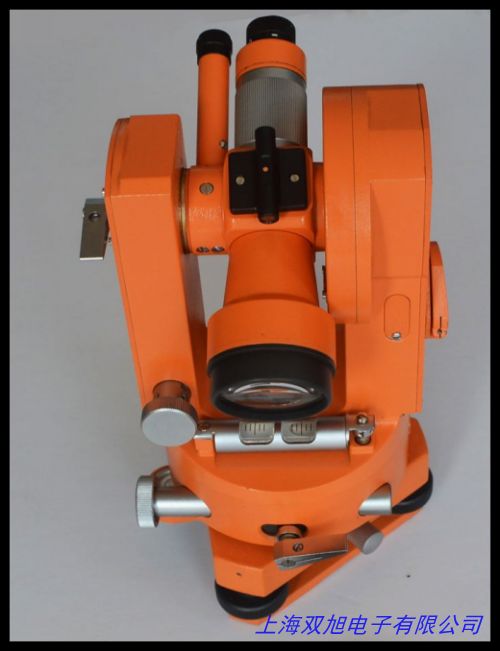
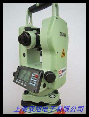
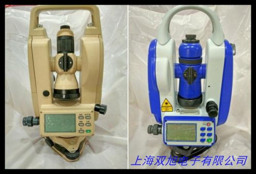
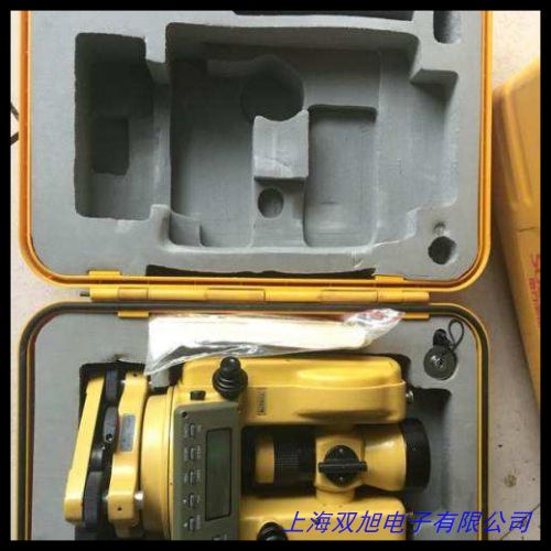
電子經緯儀產品介紹
電子經緯儀是一種集角度測量與數據電子化處理于一體的測繪設備,適用于建筑放樣、地形測繪及工業安裝。儀器采用光柵編碼技術,可實現水平角和垂直角的精確測量,最小讀數達1秒。其數字顯示屏直觀呈現測量數據,并支持數據存儲與傳輸功能。部分型號配備激光對點器,便于快速定位。電子經緯儀操作簡便,適用于橋梁、隧道等高精度工程場景,如DT22L等型號兼具穩定性和實用性。
The electronic theodolite integrates angle measurement with digital data processing, suitable for construction layout, topographic mapping, and industrial installation. Utilizing grating encoding technology, it achieves precise horizontal and vertical angle measurements with a minimum reading of 1 second. The digital display provides real-time data visualization, complemented by data storage and transmission capabilities. Some models include a laser plummet for rapid positioning. Designed for ease of use, it is widely applied in high-precision projects like bridges and tunnels, with models such as DT22L balancing reliability and functionality.
全站儀產品介紹
全站儀是一種多功能測繪儀器,結合角度、距離、坐標測量與數據處理功能,廣泛應用于工程建設和地形測繪。儀器采用同軸望遠鏡設計,支持棱鏡和無棱鏡測距模式,測程可達1500米。其高精度測角系統(如1秒級)和智能化應用程序(如道路放樣、面積計算)顯著提升工作效率。全站儀具備堅固外殼和IP66防護等級,適應戶外復雜環境,典型型號如RTS312、GTS-1000系列,是施工測量與變形監測的理想設備。
The total station is a versatile surveying instrument integrating angle, distance, and coordinate measurement with data processing. Featuring a coaxial telescope, it supports prism and prismless distance measurement up to 1500 meters. High-precision angle measurement (e.g., 1-second accuracy) and smart applications (e.g., road staking, area calculation) enhance operational efficiency. With a rugged design and IP66 protection, it performs reliably in challenging outdoor conditions. Models like RTS312 and GTS-1000 series are preferred for construction surveys and deformation monitoring.
測繪建筑儀器綜合應用
上述儀器可協同完成從基礎測量到復雜工程的全流程作業。自動安平水準儀確保高程精度,電子經緯儀提供角度基準,全站儀實現綜合數據采集,形成高效測繪解決方案。這些設備廣泛應用于軌道交通、水利工程、城市規劃等領域,以穩定性能和用戶友好設計滿足多樣化需求。
These instruments work collaboratively to cover tasks from basic surveying to complex engineering. The auto-leveling level guarantees elevation accuracy, the theodolite establishes angular reference, and the total station enables comprehensive data collection, forming an efficient surveying system. Widely used in rail transit, water conservancy, and urban planning, they deliver consistent performance and user-centric design for diverse project requirements.
49112226
自動安平水準儀 電子經緯儀 全站儀 測繪儀器建筑儀器
水準儀DS32自動安平32倍水平儀高精度水準儀經緯儀 ,代理日本RIKEN理研RRL1828/2030/2538/2020/2420丸型水準器,帶磁 帶底座 電視架 水準器 水準泡 條式水平儀 貨架水平儀,機械調平專用水平儀 水準泡萬向水平珠水平泡66*10mm,J2-2光學經緯儀,質量保證,專業設計。 條式水平儀,框式水平儀機械水平儀,測繪儀器/三腳架/經緯儀三腳架/經緯儀木三腳架,經緯儀DT-02 瑞得經緯儀,市政工程機械上海園林機械設備經緯儀,DJD-JC系列激光電子經緯儀 博飛激光經緯儀。CS625土壤水分傳感器美國CSI Campbell,加厚水準經緯全站垂準掃平水平儀器三腳架,生產165*48高精度合像水平儀 0.01光學合像水平儀,Garmin佳明eTrex209x 高精度手持GPS經緯度定位儀測繪采集器。DJD-JC激光電子經緯儀 激光電子經緯儀,Met Station OneMSO-232微型氣象站,迷你水平儀 支架水平儀 電視架水平器,電力承裝修試一級二級三級四級五級辦資質工具 高精度經緯儀,各種鑰匙扣型水平儀。
上一篇 經緯儀全站儀配件 保護箱 防護箱子 經緯儀箱子 全站儀箱子 http://www.uoncy.cn/product/d122283.html
|


