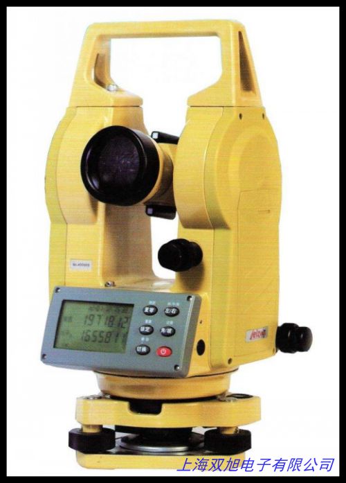
集思寶G138BD戶外手持gps北斗定位 手持機(jī)GPS定位器GPS經(jīng)緯度定位
產(chǎn)品概述
集思寶G138BD是一款高性能戶外手持GPS定位設(shè)備,支持北斗、GPS和GLONASS三大衛(wèi)星系統(tǒng),適用于野外測繪、農(nóng)業(yè)測量、戶外探險(xiǎn)等場景。其緊湊的三防設(shè)計(jì)(IP67防護(hù)等級)和多種供電模式(干電池/鋰電池/USB)確保在復(fù)雜環(huán)境中穩(wěn)定運(yùn)行。設(shè)備內(nèi)置全國導(dǎo)航地圖,支持等高線加載和沿路導(dǎo)航功能,同時(shí)配備電子羅盤與氣壓計(jì),可輔助高程測量。
核心功能
該設(shè)備采用72通道衛(wèi)星接收技術(shù),單點(diǎn)定位精度為2-5米(啟用SBAS差分校正后可達(dá)1-3米),支持WGS84、CGCS2000等100多種坐標(biāo)系統(tǒng)轉(zhuǎn)換。4GB內(nèi)存與32GB擴(kuò)展存儲空間可滿足海量數(shù)據(jù)存儲需求,數(shù)據(jù)可通過MiniUSB接口導(dǎo)出為GIS或Excel格式。2.4英寸TFT屏幕在強(qiáng)光下清晰可見,抗1.5米跌落設(shè)計(jì)進(jìn)一步提升了耐用性。
應(yīng)用場景
集思寶G138BD適用于土地測繪、林業(yè)資源調(diào)查、戶外運(yùn)動(dòng)導(dǎo)航等領(lǐng)域。其面積測量工具可通過航跡或航線快速計(jì)算區(qū)域大小,而電子羅盤和氣壓計(jì)則能輔助方向判斷與海拔測算。設(shè)備兼容多種供電方式,在無電源環(huán)境下可通過干電池續(xù)航15小時(shí),適合長時(shí)間野外作業(yè)。
技術(shù)參數(shù)
- 衛(wèi)星系統(tǒng):北斗B1、GPS L1、GLONASS L1
- 定位更新頻率:1Hz
- 工作溫度:-20℃至60℃
- 航點(diǎn)/航線存儲:3000個(gè)航點(diǎn),60條航線
- 尺寸與重量:112×68×37mm,輕便易攜帶
Product Overview
The UniStrong G138BD is a high-performance handheld GPS device supporting BeiDou, GPS, and GLONASS satellite systems, ideal for field surveying, agricultural mapping, and outdoor exploration. Its rugged IP67-rated design and multiple power options (AA batteries/lithium battery/USB) ensure reliable operation in harsh environments. Preloaded with detailed navigation maps, it supports contour line display and route navigation, while the built-in electronic compass and barometer enhance altitude measurement.
Key Features
Equipped with 72-channel satellite reception, the device achieves 2-5m single-point accuracy (1-3m with SBAS correction) and supports over 100 coordinate systems including WGS84 and CGCS2000. With 4GB internal memory and 32GB expandable storage, it handles large datasets efficiently. Data can be exported via MiniUSB in GIS or Excel formats. The 2.4-inch TFT screen remains visible under strong sunlight, and its 1.5m drop-resistant structure enhances durability.
Applications
Suitable for land surveying, forestry resource management, and outdoor navigation, the G138BD offers area calculation tools via tracks or routes. The electronic compass and barometer aid directional and elevation analysis. Its flexible power supply (15-hour battery life) supports extended field operations.
Technical Specifications
- Satellite Systems: BeiDou B1, GPS L1, GLONASS L1
- Update Rate: 1Hz
- Operating Temperature: -20℃ to 60℃
- Waypoint/Route Capacity: 3000 waypoints, 60 routes
- Dimensions: 112×68×37mm, lightweight and portable
以上內(nèi)容綜合了產(chǎn)品的功能特點(diǎn)、技術(shù)參數(shù)及適用場景,未涉及夸大宣傳或違規(guī)表述。24671226
集思寶G138BD戶外手持gps北斗定位 手持機(jī)GPS定位器GPS經(jīng)緯度定位
帶磁性底座多功能平衡角度儀坡度儀偏擺儀傾斜儀器,J2-JDE激光光學(xué)經(jīng)緯儀用于較高精度的角度坐標(biāo)測量,鋁合金木質(zhì)三腳架全站儀經(jīng)緯儀水準(zhǔn)儀專用鋁合金三角架鋁質(zhì)木支架,濰坊光學(xué)合像水平儀合象水平儀各種水平儀型號全,農(nóng)業(yè)田間大棚梯度氣候環(huán)境觀測站BLJW-6。6*15圓柱水平儀 水準(zhǔn)泡 水平泡 水平珠,防雷檢測;激光測距儀;測厚儀;經(jīng)緯儀;拉力計(jì);可燃?xì)怏w測試儀,TESA MICROBEVEL1電子水平儀/傾斜儀,紡織儀器Y511C型織物經(jīng)緯密度鏡片,各種迷你型水平儀HD-MN07。激光經(jīng)緯羅盤儀 激光經(jīng)緯羅盤儀,科技 DT-02CL 經(jīng)緯儀 上下激光 高精度測量儀 ,CH09系列時(shí)控開關(guān)生產(chǎn) 經(jīng)緯時(shí)控儀 歡迎,10X型三折式經(jīng)緯密度的觀察和分析放大鏡。蘇州一光LT402L上下激光電子經(jīng)緯儀DT402L激光對點(diǎn),激光經(jīng)緯儀,經(jīng)緯儀薄/水平儀薄/經(jīng)緯儀水平儀記錄薄/硬本野外記錄簿,AirDistSys 5000萬向微風(fēng)速監(jiān)測系統(tǒng)/環(huán)境氣流分布測試系統(tǒng),塑料材質(zhì)緯密鏡/目數(shù)鏡/篩網(wǎng)密度鏡/241織物密度鏡26-100線每英寸。
上一篇 經(jīng)緯儀 電力承裝 承修四級 辦資質(zhì)專用 經(jīng)緯測量儀 測量施工機(jī)具 http://www.uoncy.cn/product/d122466.html
|


